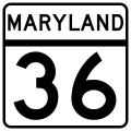
File:MD Route 36.svg
外观

此SVG文件的PNG预览的大小:600 × 600像素。 其他分辨率:240 × 240像素 | 480 × 480像素 | 768 × 768像素 | 1,024 × 1,024像素 | 2,048 × 2,048像素 | 2,400 × 2,400像素。
原始文件 (SVG文件,尺寸为2,400 × 2,400像素,文件大小:10 KB)
文件历史
点击某个日期/时间查看对应时刻的文件。
| 日期/时间 | 缩略图 | 大小 | 用户 | 备注 | |
|---|---|---|---|---|---|
| 当前 | 2006年2月22日 (三) 04:40 |  | 2,400 × 2,400(10 KB) | Jeff02 | The route marker for Maryland State Highway 36. I made this image myself using Inkscape. Made according to http://www.marylandroads.com/businesswithsha/bizstdsspecs/desmanualstdpub/publicationsonline/oots/pdf/M1-5.pdf [[Category:Maryland state highway |
文件用途
全域文件用途
以下其他wiki使用此文件:
- bn.wikipedia.org上的用途
- en.wikipedia.org上的用途
- Allegany County, Maryland
- Interstate 68
- Cumberland, Maryland
- Georges Creek Valley
- West Virginia Route 46
- Maryland Route 135
- Maryland Route 36
- Portal:U.S. roads/Selected article
- List of highways numbered 36
- U.S. Route 40 in Maryland
- Maryland Route 35
- Maryland Route 55
- Maryland Route 638
- Maryland Route 936
- Maryland Route 935
- Maryland Route 937
- Maryland Route 47
- Maryland Route 743
- Maryland Route 38
- User:Algorerhythms/MD Route Table
- User:Algorerhythms/MD Route Table split
- U.S. Route 40 Alternate (Keysers Ridge–Cumberland, Maryland)
- Portal:U.S. roads/Selected article/November 2008
- List of state highways in Maryland
- User:Epzik8/sandbox
- Wikipedia:WikiProject U.S. Roads/Redirects/Maryland/1-99
- es.wikipedia.org上的用途
- fr.wikipedia.org上的用途
- ja.wikipedia.org上的用途
- nl.wikipedia.org上的用途
- simple.wikipedia.org上的用途
- www.wikidata.org上的用途
- zh-min-nan.wikipedia.org上的用途


