File:Middle-settlement.png
外观
Middle-settlement.png (638 × 447像素,文件大小:140 KB,MIME类型:image/png)
文件历史
点击某个日期/时间查看对应时刻的文件。
| 日期/时间 | 缩略图 | 大小 | 用户 | 备注 | |
|---|---|---|---|---|---|
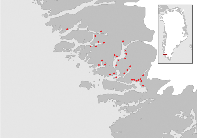
| 当前 | 2006年12月8日 (五) 08:54 |  | 638 × 447(140 KB) | Masae~commonswiki | {{Information |Description=Map of the "Middle settlement" of the Norse in medieval Greenland. No written documents of this settlement exist and the name Middle settlement is constructed by modern archaeologists. The red dots indicate known Norse farm ruin |
| 2006年12月7日 (四) 16:23 |  | 638 × 510(86 KB) | Masae~commonswiki | {{Information |Description=Map of the "Middle settlement" of the Norse in medieval Greenland. No written documents of this settlement exist and the name Middle settlement is constructed by modern archaeologists. The red dots indicate known Norse farm ruin | |
| 2006年12月7日 (四) 15:46 |  | 638 × 603(83 KB) | Masae~commonswiki | {{Information |Description=Map of the "Middle settlement" of the Norse in medieval Greenland. No written documents of this settlement exist and the name Middle settlement is constructed by modern archaeologists. |Source=Saga trails, Jette Arneborg, Danma |
文件用途
以下页面使用本文件:
全域文件用途
以下其他wiki使用此文件:
- ca.wikipedia.org上的用途
- da.wikipedia.org上的用途
- de.wikipedia.org上的用途
- en.wikipedia.org上的用途
- es.wikipedia.org上的用途
- fi.wikipedia.org上的用途
- fr.wikipedia.org上的用途
- is.wikipedia.org上的用途
- uk.wikipedia.org上的用途


