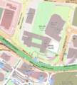
File:Umbrella Square HK.png
外观

本预览的尺寸:539 × 600像素。 其他分辨率:216 × 240像素 | 431 × 480像素 | 682 × 759像素。
原始文件 (682 × 759像素,文件大小:362 KB,MIME类型:image/png)
文件历史
点击某个日期/时间查看对应时刻的文件。
| 日期/时间 | 缩略图 | 大小 | 用户 | 备注 | |
|---|---|---|---|---|---|
| 当前 | 2014年11月28日 (五) 06:59 |  | 682 × 759(362 KB) | Ohconfucius | =={{int:filedesc}}== {{Information |description={{en|1=Umbrella Square from OpenStreetMap The extremes of the map are: *N = 22.28231, *S = 22.27879, *W = 114.16377, *E = 114.16719, }} |date=2014-11-28 |source=OpenStreetMap, http://www.openstreetmap.o... |
文件用途
以下页面使用本文件:
全域文件用途
以下其他wiki使用此文件:
- en.wikipedia.org上的用途
- tr.wikipedia.org上的用途
- www.wikidata.org上的用途


