跳转到内容

File:DavidsonTrig.jpg

页面内容不支持其他语言。
这个文件来自维基共享资源
维基百科,自由的百科全书

原始文件 (718 × 898像素,文件大小:59 KB,MIME类型:image/jpeg


描述
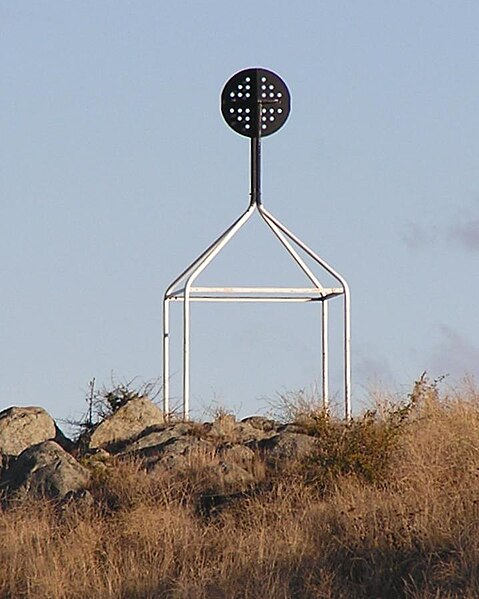
English: Davidson en:Trig point on en:Red Hill, Australian Capital Territory.

From ACT Govt info on Survey Control Marks - In the ACT trig stations consist of a ground mark with a white quadripod supporting a black disc above the ground mark. Most of these Trig Stations are part of the ACT Precision Zone: a national geodetic survey and adjustment carried out in the early 1970s. The ACT Precision Zone and its associated marks have been the primary control for all new development in the ACT since the early 1970s. The accuracy of ACT Precision Zone marks is 1 in 250,000.

Further information on Geodetic survey in Australia - now and history.
日期 2005年5月2日 (原始上传日期)
来源 Transferred from en.wikipedia to Commons by Bidgee using CommonsHelper.
作者 英语维基百科Matilda
授权
(二次使用本文件)
PD-USER-W|EN|WIKIPEDIA.

许可协议

Public domain 本作品已被作者英语维基百科AYArktos释出到公有领域。这适用于全世界。
在一些国家这可能不合法;如果是这样的话,那么:
AYArktos无条件地授予任何人以任何目的使用本作品的权利,除非这些条件是法律规定所必需的。

原始上传日志

The original description page was here. All following user names refer to en.wikipedia.
  • 2005-05-02 00:25 Matilda 718×898× (60281 bytes) Davidson [[Trig point]] on [[Red Hill, Australian Capital Territory]]. From [http://www.actpla.act.gov.au/actlic/surveycontrolmarks/ ACT Govt info on Survey Control Marks] - In the ACT trig stations consist of a ground mark with a white quadripod support

说明

添加一行文字以描述该文件所表现的内容

此文件中描述的项目

描绘内容

image/jpeg

校验和 简体中文(已转写)

86dc11e243454fab0d65f0a662dbfde914c71717

断定方法:​SHA-1 简体中文(已转写)

数据大小 简体中文(已转写)

60,281 字节

898 像素

718 像素

文件历史

点击某个日期/时间查看对应时刻的文件。

日期/时间缩⁠略⁠图大小用户备注
当前2009年1月3日 (六) 01:592009年1月3日 (六) 01:59版本的缩略图718 × 898(59 KB)Bidgee{Information |Description={{en|Davidson en:Trig point on en:Red Hill, Australian Capital Territory. From [http://www.actpla.act.gov.au/actlic/surveycontrolmarks/ ACT Govt info on Survey Control Marks] - In the ACT trig stations consist of

以下页面使用本文件:

全域文件用途

以下其他wiki使用此文件:

元数据