
File:Map Gulf of Finland-en.svg

此SVG文件的PNG预览的大小:800 × 457像素。 其他分辨率:320 × 183像素 | 640 × 366像素 | 1,024 × 585像素 | 1,280 × 731像素 | 2,560 × 1,463像素 | 1,400 × 800像素。
原始文件 (SVG文件,尺寸为1,400 × 800像素,文件大小:373 KB)
摘要
| 描述 |
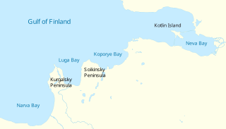
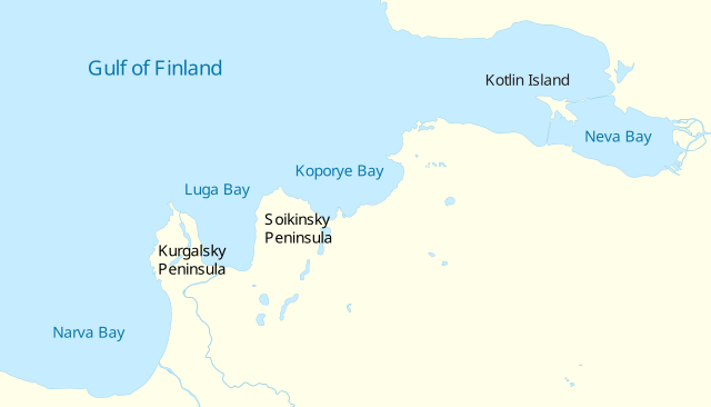
English: Gulf of Finland. Vector map
Русский: Финский залив. Векторная карта
Suomi: Suomenlahti.
Eesti: Soome laht.
Svenska: Finska viken.
Deutsch: Finnische Meerbusen. |
| 日期 | (UTC) |
| 来源 | |
| 作者 |
|
| 其他版本 |
[]
|


|
This SVG file contains embedded text that can be translated into your language, using any capable SVG editor, text editor or the SVG Translate tool. For more information see: About translating SVG files. |
| 我,本作品著作权人,释出本作品至公有领域。这适用于全世界。 在一些国家这可能不合法;如果是这样的话,那么: 我无条件地授予任何人以任何目的使用本作品的权利,除非这些条件是法律规定所必需的。 |
文件历史
点击某个日期/时间查看对应时刻的文件。
| 日期/时间 | 缩略图 | 大小 | 用户 | 备注 | |
|---|---|---|---|---|---|
| 当前 | 2009年5月4日 (一) 16:04 | | 1,400 × 800(373 KB) | Ahnode | {{Information |Description={{en|1=Vector map of the Gulf of Finland, North-Eastern Europe.}} {{ru|1=Векторная карта Финского залива.}} |Source=*Finnish_bay,_NLT_Landsat7.png |Date=2009-05 |
文件用途
全域文件用途
以下其他wiki使用此文件:
- ba.wikipedia.org上的用途
- ceb.wikipedia.org上的用途
- cs.wikipedia.org上的用途
- en.wikipedia.org上的用途
- es.wikipedia.org上的用途
- fi.wikipedia.org上的用途
- fr.wikipedia.org上的用途
- hr.wikipedia.org上的用途
- it.wikipedia.org上的用途
- lt.wikipedia.org上的用途
- nn.wikipedia.org上的用途
- no.wikipedia.org上的用途
- pt.wikipedia.org上的用途
- ru.wikipedia.org上的用途
- sv.wikipedia.org上的用途
- tt.wikipedia.org上的用途
- www.wikidata.org上的用途