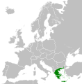
File:Kingdom of Greece (1973).svg
頁面內容不支援其他語言。
外觀

此 SVG 檔案的 PNG 預覽的大小:450 × 456 像素。 其他解析度:237 × 240 像素 | 474 × 480 像素 | 758 × 768 像素 | 1,011 × 1,024 像素 | 2,021 × 2,048 像素。
原始檔案 (SVG 檔案,表面大小:450 × 456 像素,檔案大小:465 KB)
摘要
說明
添加單行說明來描述出檔案所代表的內容
在此檔案描寫的項目
描繪內容
沒有維基數據項目的某些值
創用CC姓名標示-相同方式分享2.5通用版 繁體中文 (已轉換拼寫)
創用CC姓名標示-相同方式分享2.0通用版 繁體中文 (已轉換拼寫)
創用CC姓名標示-相同方式分享1.0通用版 繁體中文 (已轉換拼寫)
26 4 2012
檔案歷史
點選日期/時間以檢視該時間的檔案版本。
| 日期/時間 | 縮圖 | 尺寸 | 使用者 | 備註 | |
|---|---|---|---|---|---|
| 目前 | 2012年4月26日 (四) 15:31 |  | 450 × 456(465 KB) | TRAJAN 117 | {{Information |Description ={{en|1=The Kingdom of Greece in 1973.}} |Source ={{own}} {{AttribSVG|Blank map of Europe 1956-1990.svg|Alphathon}} |Author =TRAJAN 117 {{created with Inkscape}} |Date =2012-04... |
檔案用途
全域檔案使用狀況
以下其他 wiki 使用了這個檔案:
- ar.wikipedia.org 的使用狀況
- arz.wikipedia.org 的使用狀況
- ast.wikipedia.org 的使用狀況
- azb.wikipedia.org 的使用狀況
- az.wikipedia.org 的使用狀況
- bg.wikipedia.org 的使用狀況
- ca.wikipedia.org 的使用狀況
- ckb.wikipedia.org 的使用狀況
- cs.wikipedia.org 的使用狀況
- da.wikipedia.org 的使用狀況
- de.wikipedia.org 的使用狀況
- el.wikipedia.org 的使用狀況
- en.wikipedia.org 的使用狀況
- eo.wikipedia.org 的使用狀況
- es.wikipedia.org 的使用狀況
- et.wikipedia.org 的使用狀況
- eu.wikipedia.org 的使用狀況
- fa.wikipedia.org 的使用狀況
- fi.wikipedia.org 的使用狀況
- fr.wikipedia.org 的使用狀況
- gl.wikipedia.org 的使用狀況
- he.wikipedia.org 的使用狀況
- hy.wikipedia.org 的使用狀況
- id.wikipedia.org 的使用狀況
- it.wikipedia.org 的使用狀況
- ja.wikipedia.org 的使用狀況
- ko.wikipedia.org 的使用狀況
- ku.wikipedia.org 的使用狀況
- lv.wikipedia.org 的使用狀況
- mk.wikipedia.org 的使用狀況
- ms.wikipedia.org 的使用狀況
- pl.wikipedia.org 的使用狀況
- pnb.wikipedia.org 的使用狀況
- pt.wikipedia.org 的使用狀況
- ro.wikipedia.org 的使用狀況
- rue.wikipedia.org 的使用狀況
- ru.wikipedia.org 的使用狀況
檢視此檔案的更多全域使用狀況。
詮釋資料
此檔案中包含其他資訊,這些資訊可能是由數位相機或掃描器在建立或數位化過程中所新增的。若檔案自原始狀態已被修改,一些詳細資料可能無法完整反映出已修改的檔案。
| 簡稱 | Countries of Europe |
|---|---|
| 影像標題 | A blank Map of Europe. Every country has an id which is its ISO-3166-1-ALPHA2 code in lower case.
Members of the EU have a class="eu", countries in europe (which I found turkey to be but russia not) have a class="europe".
Certain countries are further subdivided the United Kingdom has gb-gbn for Great Britain and gb-nir for Northern Ireland. Russia is divided into ru-kgd for the Kaliningrad Oblast and ru-main for the Main body of Russia. There is the additional grouping #xb for the "British Islands" (the UK with its Crown Dependencies - Jersey, Guernsey and the Isle of Man)

Contributors.
Original Image: (http://commons.wikimedia.org/wiki/Image:Europe_countries.svg) Júlio Reis (http://commons.wikimedia.org/wiki/User:Tintazul).
Recolouring and tagging with country codes: Marian "maix" Sigler (http://commons.wikimedia.org/wiki/User:Maix)
Improved geographical features: http://commons.wikimedia.org/wiki/User:W!B:
Updated to reflect dissolution of Serbia & Montenegro: http://commons.wikimedia.org/wiki/User:Zirland
Updated to include British Crown Dependencies as seperate entities and regroup them as "British Islands", with some simplifications to the XML and CSS: James Hardy (http://commons.wikimedia.org/wiki/User:MrWeeble)
Released under CreativeCommons Attribution ShareAlike (http://creativecommons.org/licenses/by-sa/2.5/). |
隱藏分類:


